Photo Journals at Lover’s Point
A photo Journal is like the magic of telling stories through pictures, where photography and journalism dance together beautifully. It mainly captures what’s happening now and the stories that make us human.
by Marlene Krueger
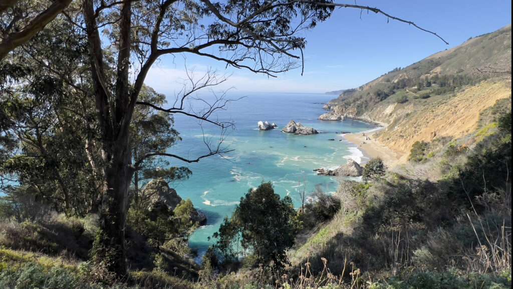
Photo Journaling at Pacific Grove
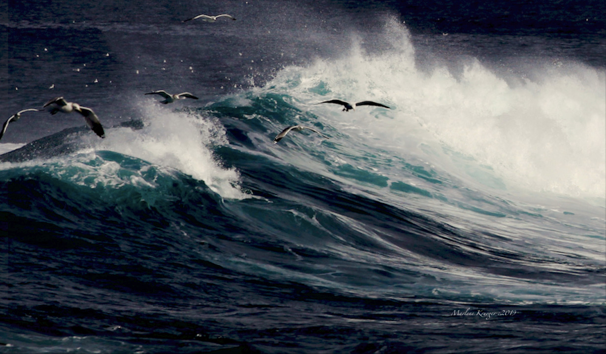
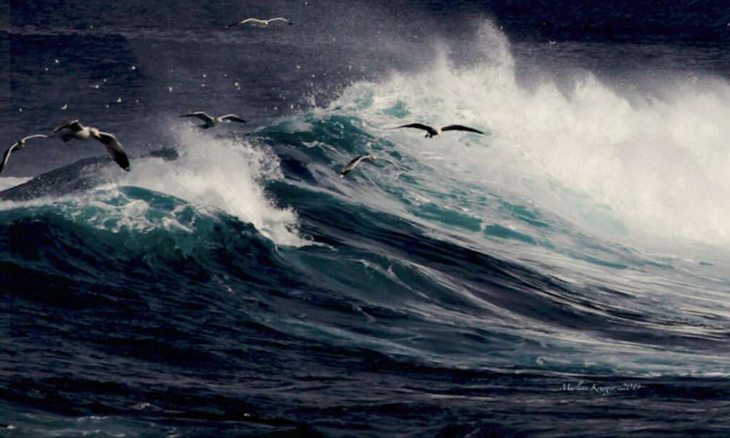
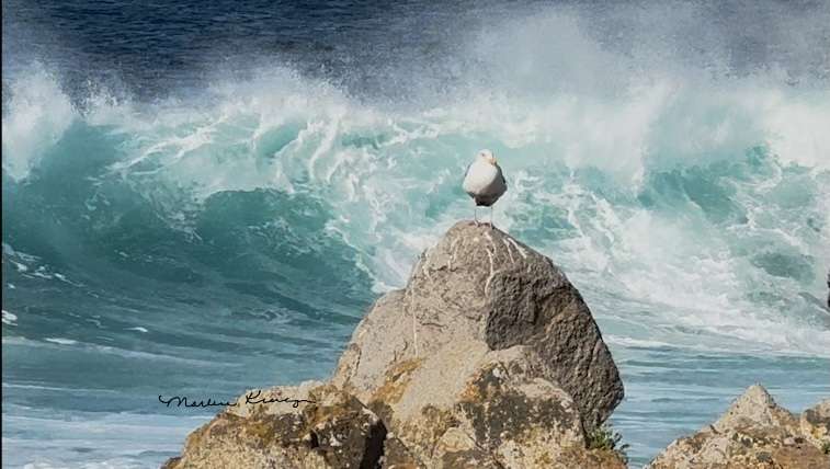
I continue with photo journals with stories flowing from nature, like the endless coastlines stretching over hundreds of miles. I take pictures and paint visions in Pacific Grove. There’s a massive boulder about a hundred feet out in the water, with crashing waves, at Point Pinos.
Little did I know growing up that the image is an iconic and featured image at the beginning of the TV show “Big Little Lies.” Imagine sitting for hours, waiting for the perfect monster wave to hit that boulder in the middle of the ocean. Not to mention, at Pacific Grove and the shoreline public parks, it’s easy to sit and mesmerize. Just imagine the deep canyon under the Monterey Bay, right here in Point Pinos!
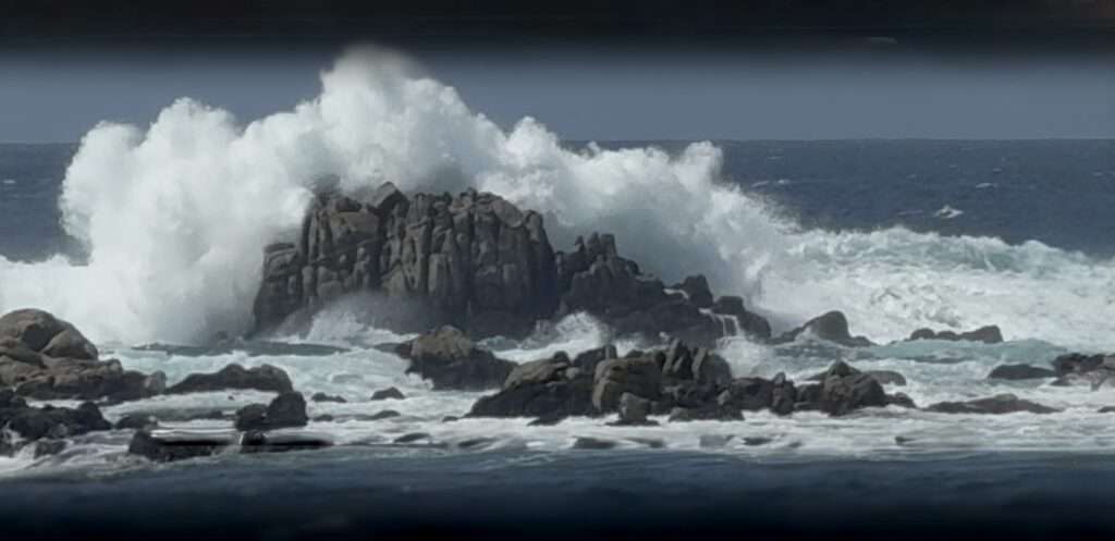
Photo Journals at Moss Landing
I began to explore how I could interpret nature in action, through images that play artistically in my heart. For instance, at Moss Landing, while relaxing and watching my father fish one day, we saw a humpback whale breached right before our eyes. What a vision, and startling. Not to mention about the sea lions in numbers and shore birds appearing a few feet away grabbing my father’s fish. How theatrical, especially at a beach like Moss Landing where my dad use to fish. Imagine, thousands of shore birds flying above the dunes and wetlands.
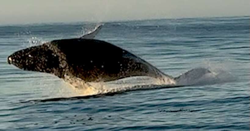
Photo Journaling at Monterey
Back on the Monterey Peninsula Recreation Trail, a novel for a book continues in my mind with words and pictures, that align with my photo journals of abstract art.
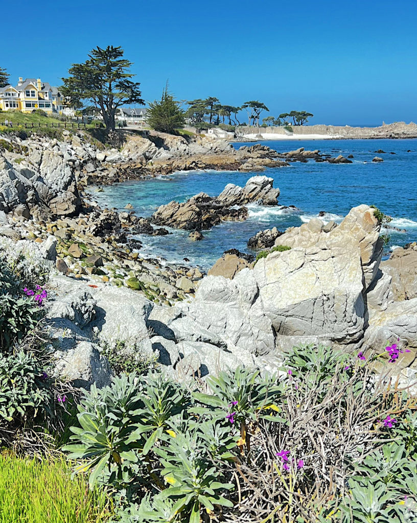
Photo Journaling at Monterey Bay
Along two public wharves, I wander though Monterey State Historic Park, and the Monterey Bay Aquarium. I was captivated by a stunning wave-kissed rocky shore, at the Monterey Peninsula tip, complete with breathtaking sandy dunes.
I’d walk through the old Del Monte Forest, noticing how the skies and clouds form images of people’s faces. Worthy to add to my novel later.
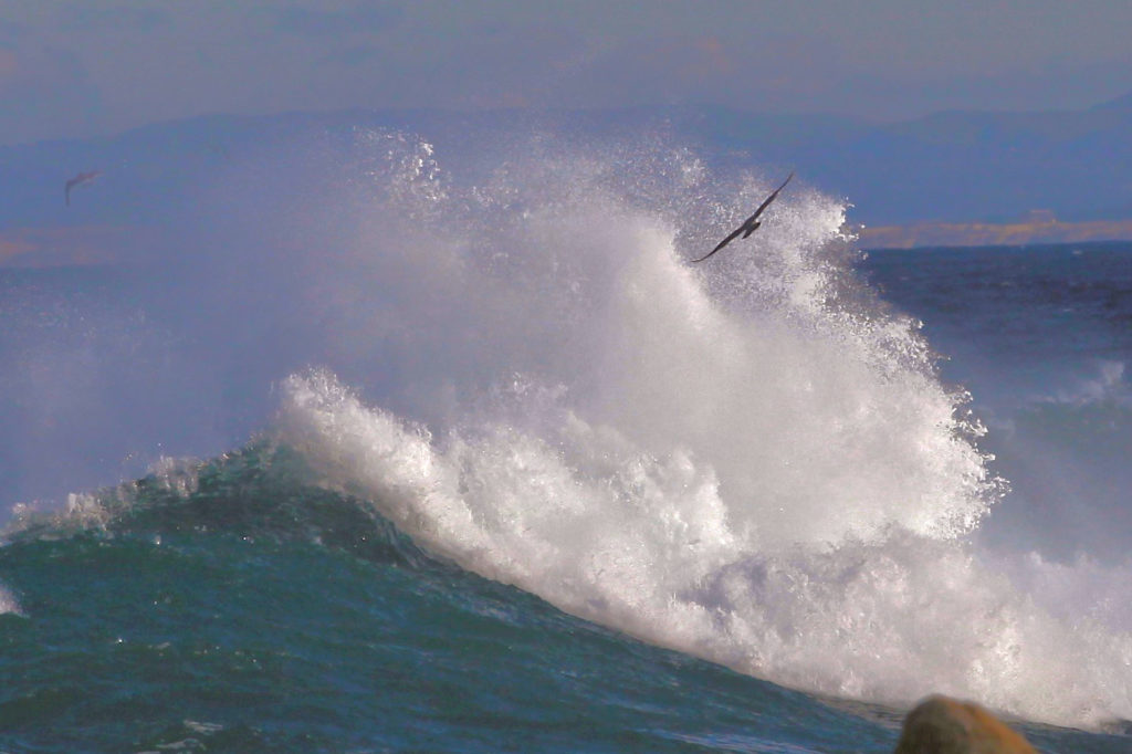
Photo Journaling at Carmel
As I kept walking, I see Carmel City Beach where friendly pets sniff my sandy toes. Wonderfully, my walk through this area was peaceful. As I turn a corner in Carmel, I follow a road down about seventeen steps to Carmel State Beach, photo journaling as I walk.
I’m ready to drive to Point Lobos State Reserve, with plenty ideas for photo journaling. Moreover, the Coastal Trail brings land and water together in a magical way. Plus, the sun casts all sorts of rainbow-like patterns on everything on the ground, which was amazing. It’s like stepping into an abstract art piece, like a rocky beach that you climb on, with every twist and turn revealing new artistic patterns by the crystal-clear sea.
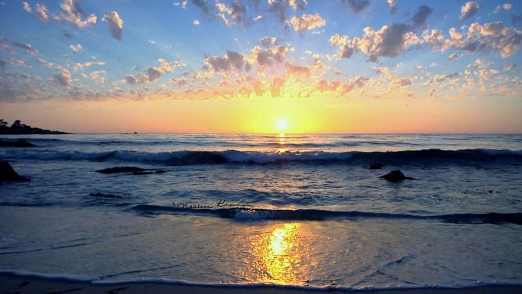
Photo Journalism at Garrapata State Park
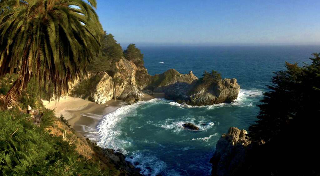
Deeper into Point Lobos, I came across China Grove. Afterwards a short drive through Highway One, watching the scenery from the shoulder, heading to Garrapata State Park. After entering the park, I snapped some photos north and south of the teal-blue horizon below. Afterwards, I drive to Big Sur, where Bixby Bridge is approaching, where we pass by another scene that look like the scene in the intro of “Big Little Lies.”
While on a rocky mouth of Bixby Creek, I suddenly got lost on a dusty, rough Old Coast Road. Carefully I maneuver through the unpaved coastal hills and valleys, and then, with a dramatic finish, I’m back to the coast!
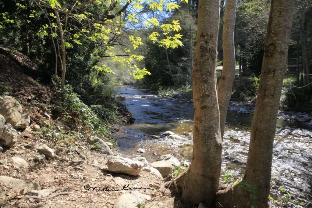
Furtheron, I made my way down to the Big Sur River, taking a moment to wander along the shore, slopes, and ridges of Andrew Molera State Park. I figured this would be the ideal spot to jot down my thoughts in the car. Moreover a safe distance from the crowd of people and the possibility of mountain lions or snakes. Afterwards, I continue my drive on Highway One and stop at Pfeiffer Big Sur State Park, where I set up camp enjoying the serenity..
I’m about to head back on Highway One, when suddenly I see a peak that I think’s perfect for California’s Coastal Trail Blazers. Located beyond a coastal range where the Ventana Wilderness reaches its highest point, crossing Cone Peak. This peak is the highest on California’s coastline, standing at just over five thousand feet.
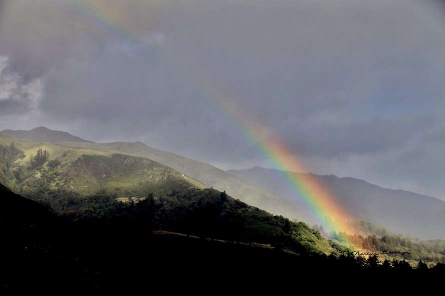
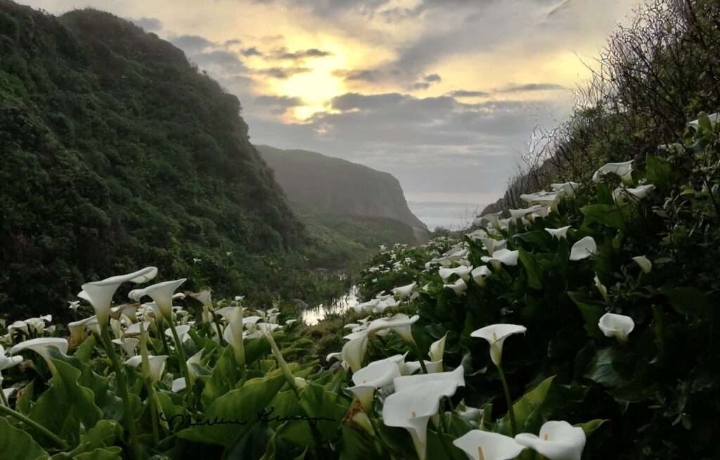
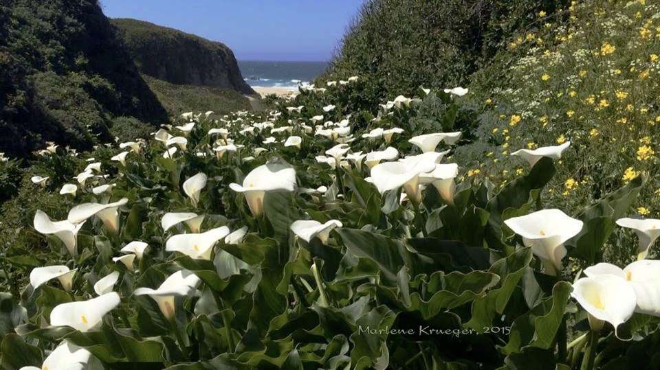
In addition, it’s high enough and scenic enough to be worth a visit, located beyond a coastal ridge. Oh wait, are you thinking there’s a pot of gold at the end of the rainbow? Most interesting is how the lower route of Big Sur offers a highway-shoulder alternative. Plus, when these routes intersect, they provide a 27-mile stretch of coastal Monterey County to explore, including Doud Creek, which is filled with Calle Lillies.
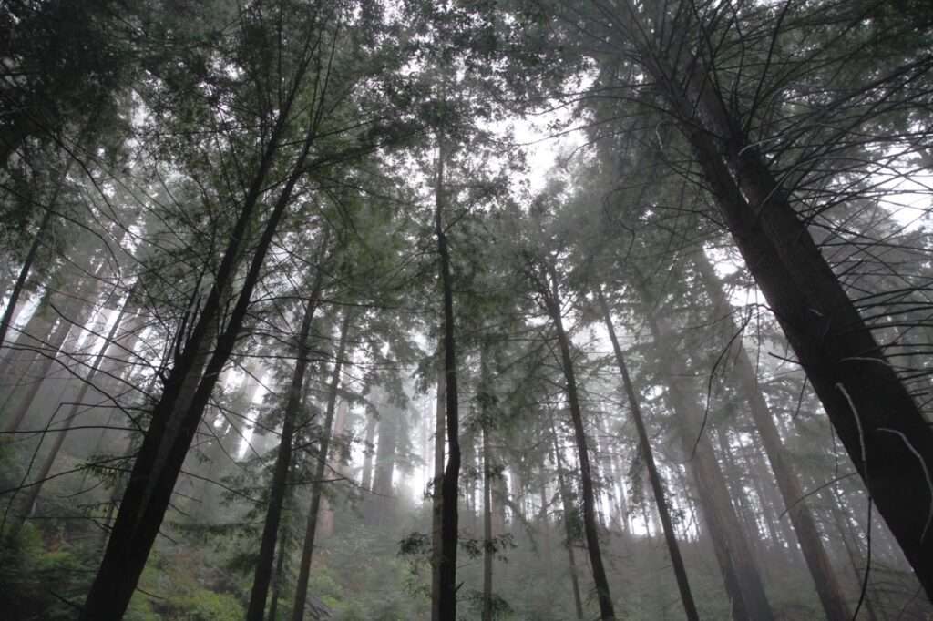
Continuing south on Highway One, beams of light streamed through the majestic tall trees along the roadside. As we can see, there’s lovely beams of light through the tall Cypress trees from the afternoon sun, filtered by shades that let you know you’re in Big Sur.
Upon arrival at Pfeiffer Beach, where the huge boulder-like tower that everyone loves photographing at sunset sits, like between crashing waves, beach and wavy trails of purple marbling on the sand. Right below my bare feet — and cold. Brrrrrrrrra
Thunderous crashing waves, was sort of like music, as if they were choreographed, gave me a peek through the keyhole where the winter sun sparkled, and a few photos taken. Eventually I was ready to leave driving south, for a quick walk at Julia Pfeiffer’s McWay Falls, to soak in all the sights and sounds. That teal is so unreal. But it’s real.
Finally, I drive passing the tiny town of Gorda. In minutes, I turned into Kirk Creek Campground. Mesmerize as I checked in, it’s time to search for my spot, next to a beach fifty feet below. It’s only a few feet away and looking down are the crashing waves. So this is where I rest. I lie on my back half-asleep, staring at a millions bright stars above that lit up the whole campground.
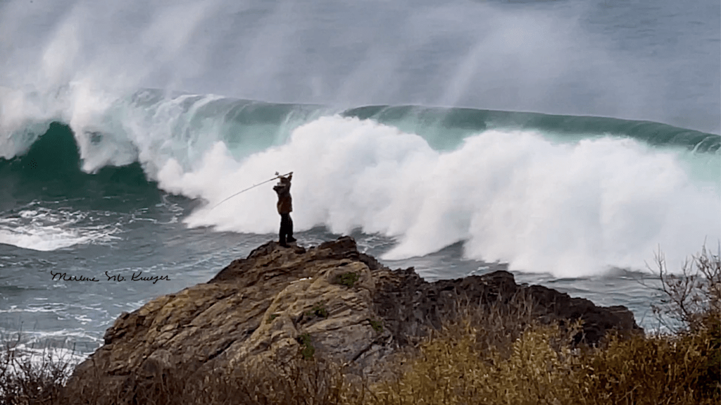
The alarm at sunrise, was a raccoon nibbling at a garbage can for food, and a cup of hot chocolate with a sip or two before I walk down Willow Creek. The sparkly water of the rushing creek toward the ocean put me in a trance-like walk. Scary, there was a fisherman standing on a hundred-foot-high boulder at the edge of these wild waves. Imagine—it’s like the waves were about to sweep him away. Oh well, I’m heading for Jade Beach now to look for jade — but nothing, so I kept driving south to photo journal the waterfall seen from Highway One at Salmon Creek. Suddenly the sound of the misty waterfall was music to my ears. From here, I u-turn back and watch the sunset on my way home.
By Marlene Krueger